Various Maps
Dearnley origins
Glossop c.1878
Glossop pictorial street map c.1897
Digley (Holme Valley at the time of the flood) c.1852
Almondbury 1854
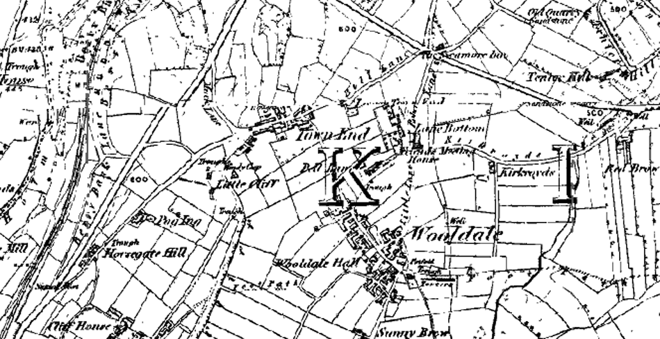
Wooldale 1854
Glossop c.1878
Glossop pictorial street map c.1897
Digley (Holme Valley at the time of the flood) c.1852
Almondbury 1854
Wooldale 1854
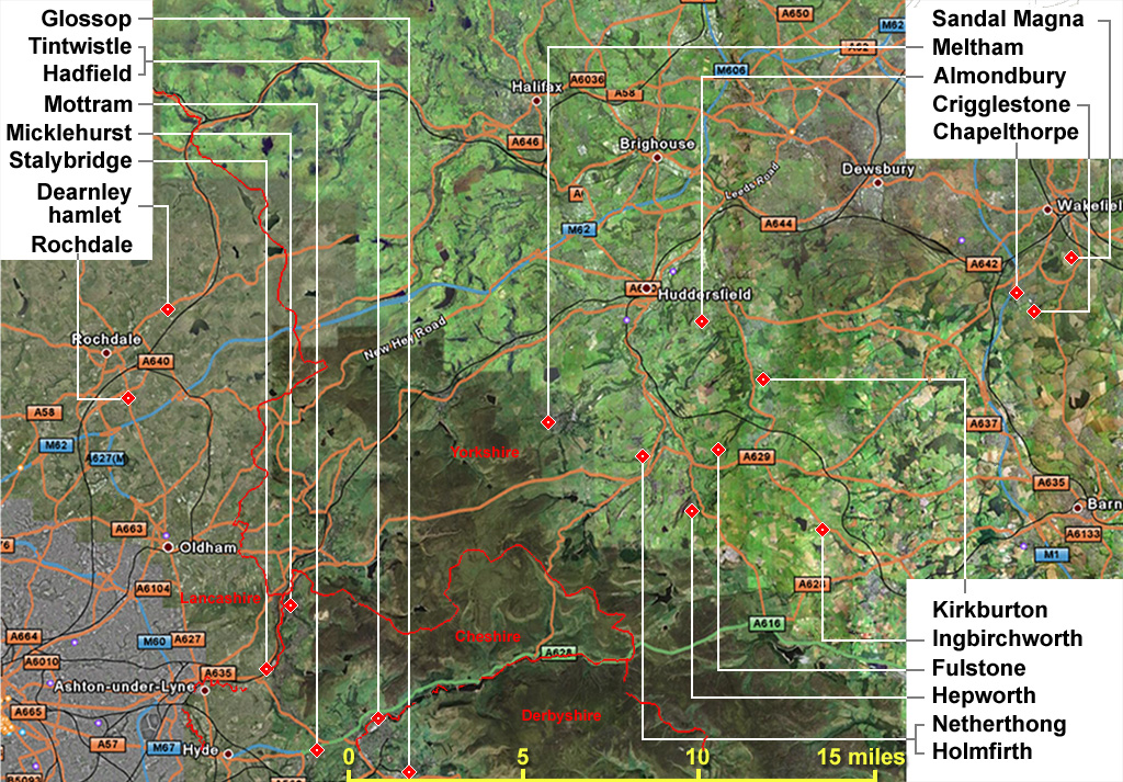
Dearnley / Dearnaley + origins
images courtesy of Google maps
County borders are from data provided by the Historic County Borders Project.
County borders are from data provided by the Historic County Borders Project.
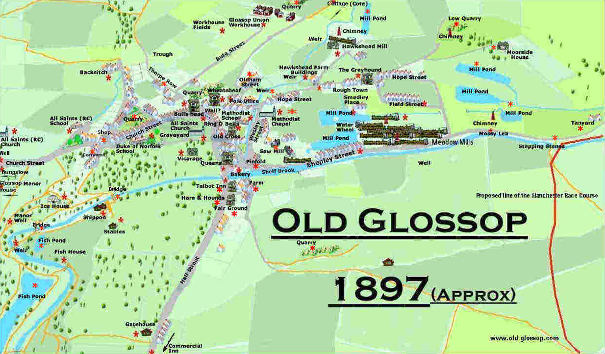
Glossop c.1897
Historic pictorial street map of Old Glossop, High Peak, Derbyshire, England drawn by Ivan Bell
Historic pictorial street map of Old Glossop, High Peak, Derbyshire, England drawn by Ivan Bell
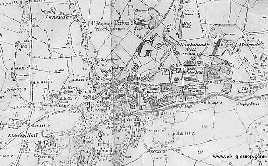
Glossop 1878

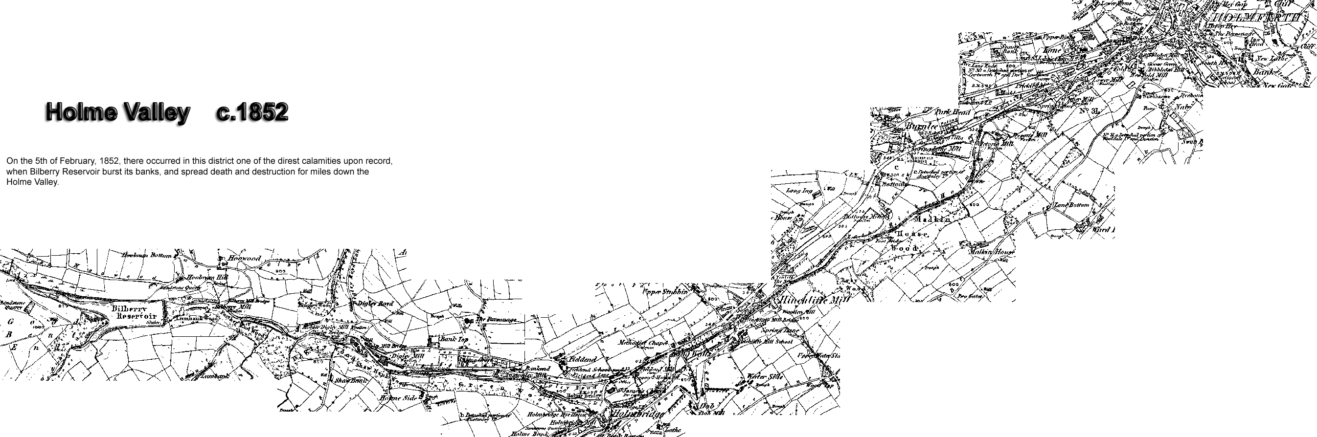
correction: the above map is actually Digley. The only part of the Holme valley is where Digley brook meets the Holme at Holmbridge at the east end.
from:
Floods in the Holme Valley
page 229
By far the most calamitous flood which this district ever sustained, was occasioned by the bursting of the Bilberry Reservoir, at the head of the Holme valley, early on the morning of the 5th February, 1852.
//
page 235
The Holmfirth Mill, then occupied by Messrs. Nathan Thewlis and Co., and employed in the woollen manufacture, was assailed by this mighty torrent, which rushed through the two low stories, smashing the machinery, and inflicting a great amount of damage. Adjoining the mill were two cottages - one occupied by Richard Shackleton, weaver, his wife and three children; the other by Sidney Hartley (engineer to Messrs. Nathan Thewlis and Co.), his wife, eight children, and an apprentice boy (John Dearnley). Both these cottages, together with the families, were swept away, except three little girls, the children of Sidney Hartley, and the apprentice boy, who, being suddenly floated up to a part of the roof which yet remained, caught hold of the rafters and clung to them. When the flood began to abate, John Dearnley got upon the roof, and assisted the little girls to do the same, and ultimately enabled them to gain a place of greater safety.
//
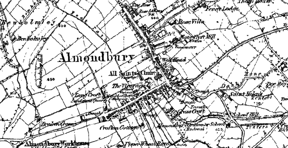
Almondbury 1854 OS
A few D. locations
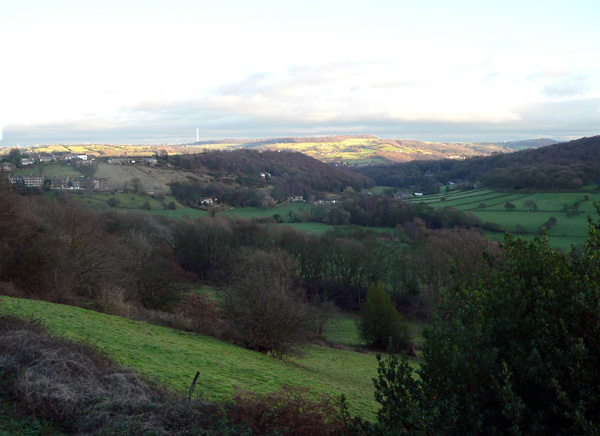
Here are a few Dearnley locations.
The picture is taken looking eastwards from
here
The far side of the valley is Honley Wood Bottom, home of Oliver D & some of his descendants with Honley Wood occupying the far side of the valley. The valley turns and runs behind the end of the nearer ridge to join the main Holme Valley. Honley village is sitting on top of the ridge opposite - if you zoom in you can see the tower of St Mary's which was the Honley chapel.
On the horizon at the left hand end the long white building with the dark roof and an outbuilding with the gable turned to the camera is Stirley Hill on the far side of the Holme Valley where Joseph D lived. The valley side below it is Park and to the left is Ashes Lane. The latter two are places where Roger D, Oliver's contemporary lived. Lumb where some of the Stirley Hill descendants lived is behind the far ridge at the left hand end at the top of a side valley and Bottoms where Valentine D lived is further down that little valley.
Further to the right you can see the top of Emley Moor TV mast about 7 miles distant. Kirkburton where many of the Dearnleys were married and buried lies in that direction. The village on the horizon just to the left of the mast is Farnley Tyas - I don't think we have any Dearnleys there.
Down near the bottom of the far valley is Grange (near Thunder Bridge on the map) where Roger D finally settled & where the family seems to have lived on largely under the radar for another generation or two. Joseph D of Stirley Hill is said to have been from Kirkburton parish so I think it likely that he would have been one of that family. Grange is in Thurstonland township & Thurstonland village in on the horizon towards the right hand end.
Ian Goddard